


ORLANDO, Fla.—Expectations for an extraordinarily active 2024 hurricane season remain essentially unchanged, after NOAA released its midseason forecast Thursday.
The National Oceanic and Atmospheric Administration predicted 17 to 24 named storms, a slight revision down from its May forecast, which had called for 17 to 25 named storms. That was the most named storms the federal agency had projected since the forecasts began in 1998.
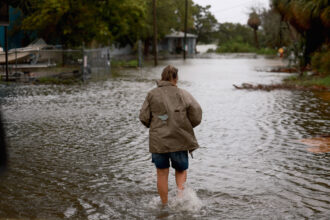
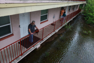
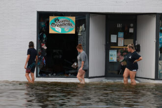
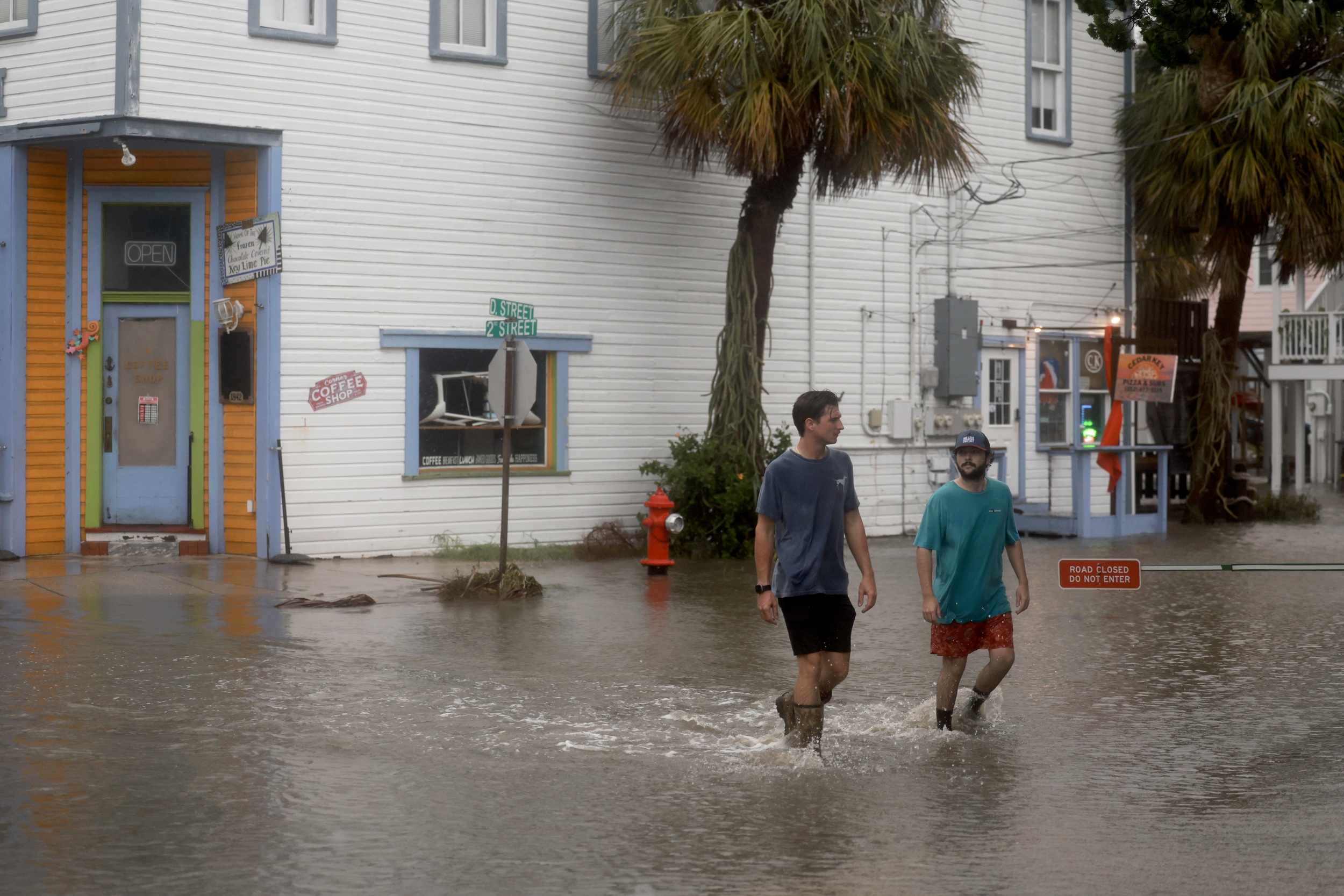
The latest forecast included eight to 13 hurricanes and four to seven major hurricanes of category 3, 4 or 5 strength, packing winds of 111 miles an hour or more. The numbers included the four named storms that already have developed this season. Among them was Debby, which drenched the Southeast this week after making landfall Monday in Florida as a category 1 hurricane.
By Friday Debby had weakened, although the storm’s remnants continued to pose a flood risk for the Carolinas and bring tornado threats to the Northeast.

Explore the latest news about what’s at stake for the climate during this election season.
The average season features 14 named storms, including seven hurricanes and three major hurricanes. NOAA typically issues an updated forecast in August near the heart of the season, which begins June 1 and ends Nov. 30.
“All the indicators that go into these seasonal forecasts are lined up for a very active season, so that is very concerning,” said David Zierden, Florida’s state climatologist based at the Center for Ocean-Atmospheric Prediction Studies at Florida State University. “To me the biggest worry is a storm that does form can be stronger this year.”
NOAA based its forecast most notably on unusually warm sea surface temperatures in the tropical Atlantic Ocean and Caribbean Sea, as warm waters can fuel hurricanes. The agency also cited reduced vertical wind shear or atmospheric choppiness that can weaken or break apart storms, weaker tropical Atlantic trade winds and an enhanced west African monsoon. A transition to La Niña conditions, which can enhance hurricane activity, also was expected.
The conditions were projected to continue into the fall. NOAA said dry Saharan air that prevented tropical storm development over the summer likely would subside in August. The agency said there was a 10 percent chance of a near-normal season and negligible chance of a below-normal season. The forecast was for overall seasonal activity and did not address landfalls, which are determined mostly by short-term weather patterns.
The hurricane season got off to an explosive start in July with Beryl, the earliest category 5 hurricane on record in the Atlantic basin. The hurricane caused catastrophic damage on several Caribbean islands before losing strength and making landfall as a category 1 storm near Matagorda, Texas, between Corpus Christi and Galveston.
Thursday’s forecast was consistent with another update from Colorado State University, which called for 23 named storms including 12 hurricanes and six major hurricanes. The prediction for 12 hurricanes, which researchers also forecast in 2020, is the most hurricanes the Colorado State team projected in an August outlook.
About This Story
Perhaps you noticed: This story, like all the news we publish, is free to read. That’s because Inside Climate News is a 501c3 nonprofit organization. We do not charge a subscription fee, lock our news behind a paywall, or clutter our website with ads. We make our news on climate and the environment freely available to you and anyone who wants it.
That’s not all. We also share our news for free with scores of other media organizations around the country. Many of them can’t afford to do environmental journalism of their own. We’ve built bureaus from coast to coast to report local stories, collaborate with local newsrooms and co-publish articles so that this vital work is shared as widely as possible.
Two of us launched ICN in 2007. Six years later we earned a Pulitzer Prize for National Reporting, and now we run the oldest and largest dedicated climate newsroom in the nation. We tell the story in all its complexity. We hold polluters accountable. We expose environmental injustice. We debunk misinformation. We scrutinize solutions and inspire action.
Donations from readers like you fund every aspect of what we do. If you don’t already, will you support our ongoing work, our reporting on the biggest crisis facing our planet, and help us reach even more readers in more places?
Please take a moment to make a tax-deductible donation. Every one of them makes a difference.
Thank you,

Amy Green
Reporter, Florida
Amy Green covers the environment and climate change from Orlando, Florida. She is a mid-career journalist and author whose extensive reporting on the Everglades is featured in the book MOVING WATER, published by Johns Hopkins University Press, and podcast DRAINED, available wherever you get your podcasts. Amy’s work has been recognized with many awards, including a prestigious Edward R. Murrow Award and Public Media Journalists Association award.