


Tropical Storm Debby, a plodding, waterlogged system that has already saturated four southeastern states, bears many characteristics of a warming planet, climate scientists say. It’s reminiscent of other catastrophic tropical cyclones that have battered the United States over the past eight years.
On Wednesday afternoon, the storm was drifting at 5 mph near the South Carolina coast, about the pace of a monarch butterfly. It is expected to pick up speed today as it heads through North Carolina, where a foot or more of rain could fall in the southeastern part of the state and 6 to 8 inches are anticipated in the central Piedmont.
North Carolina Gov. Roy Cooper declared a state of emergency this week, warning residents on Wednesday to “be prepared for a deluge.”
A warmer atmosphere holds more water; likewise, warmer temperatures accelerate evaporation. “There’s a lot of water in this system that’s just ready to come out,” North Carolina’s state climatologist, Kathie Dello, said. “We’re pulling more of that moisture into the air and essentially supercharging the atmosphere. Or, as I like to say, get a cup of coffee and pour in a few shots of espresso.”

Explore the latest news about what’s at stake for the climate during this election season.
Tropical Storm Debby has arrived in what is on track to be one of the top 10 warmest years on record in North Carolina. As recently as late June, 99 of the state’s 100 counties were experiencing drought conditions ranging from abnormally dry to severe, according to the State Climate Office.
That pattern reversed in July, when several cities reported their wettest July on record.
“Swings between wet and dry are something that we’re expecting with climate change,” Dello said. “The extremes become more extreme.”
Tropical Storm Debby is reminiscent of two historic hurricanes that hit North Carolina—Matthew in 2016 and Florence in 2018. Although both were Category 1 storms, they caused disproportionate damage because they stalled over land and dumped historic amounts of rain—as much as 3 feet—in eastern North Carolina. Thousands of people were left homeless and damages totaled in the billions of dollars.
Tropical storms and hurricanes are producing heavier rain over the U.S., an indicator of climate change, according to a study published last month in the Journal of Climate, a publication of the American Meteorological Society.
John Uehling co-authored the paper with Carl Schreck III, both of whom are scientists at the North Carolina Institute for Climate Studies.
Uehling told Inside Climate News that Tropical Storm Debby is “a classic case of what we’ve seen a lot in recent years,” including with Hurricanes Harvey and Florence, “where we have a stalling storm near the coastline that basically dumps rain over the same areas for an extended and prolonged period of time.”
Using historical rainfall gauge data, Uehling and Schreck found that instances of heavy rain associated with tropical cyclones are becoming more frequent and extreme. Major hurricanes—those in categories 3 through 5—show the largest increases in extreme rainfall.
“The real impact that we’re seeing is where the worst events are getting significantly worse,” Uehling said, whereas, in general “your more run-of-the-mill events are not increasing at nearly the same rate.”
The study’s findings could help local governments, planners and residents prepare for these weather disasters to occur more frequently, Uehling said.
That includes inland areas in particular, where the study found the highest increases in rainfall: Alabama and Mississippi through southern Appalachia, including the mountains of North Carolina. Flooding in higher elevations presents different threats—including mudslides and more challenging evacuations—than coastal areas.
“Places that have not been used to dealing with these kinds of threats are going to have to start dealing with them more often,” Uehling said.
“It’s important that people keep in mind that our climate is changing, that these sort of events are occurring with more and more frequency, and that the impacts seem to be getting greater,” he said. “We have a duty as a society not only to mitigate against these changes, but to do what we can to prevent them from getting worse.”
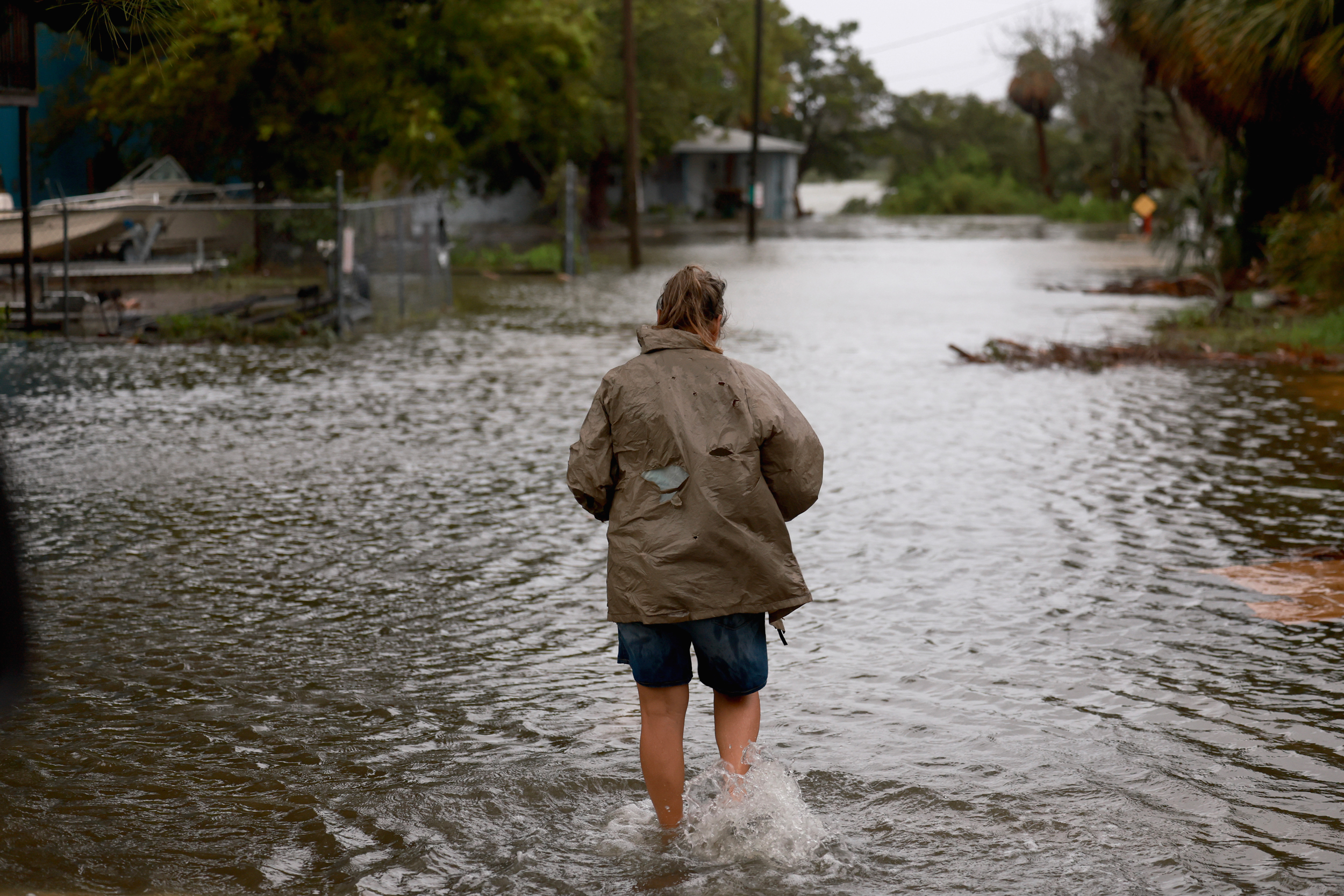
Debby made landfall Monday morning near Steinhatchee, Fla., in the state’s sparsely populated Big Bend region, so named for the way the peninsula meets the Panhandle. The category 1 storm forged a path similar to that of last year’s Idalia, a category 3 hurricane that was the strongest to strike this part of the state since 1896.
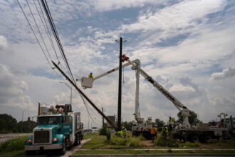
Hundreds of thousands of Floridians lost power and Gov. Ron DeSantis declared a state of emergency in 61 of the state’s 67 counties. More than 9,400 feet of what his administration characterized as flood protection devices were deployed at critical infrastructure sites such as schools, health care facilities and roads and bridges. For the first time flood control barriers also were positioned around utility substations, to try to prevent more power outages, his administration said.
Florida officials feared more flooding later in the week, as water continued to flow south from the rain-soaked states of Georgia and the Carolinas. By Wednesday, the Florida Division of Emergency Management had pumped more than 104 million gallons of floodwater from communities across the state, the DeSantis administration said.
“This could take anywhere from three to seven days,” said Kevin Guthrie, executive director of the Florida Division of Emergency Management, of the duration of the flooding in the state. “This is going to be about a weeklong event that we’re going to be monitoring.”
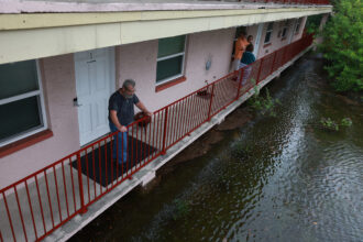
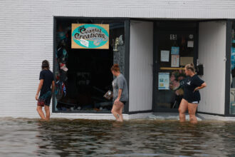
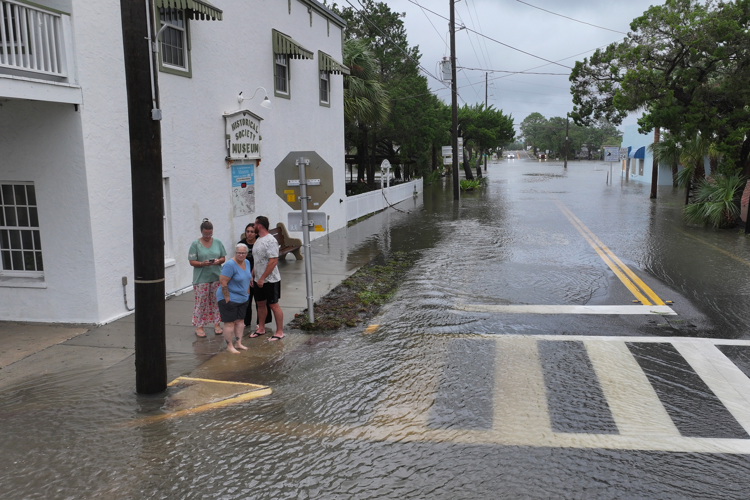
Some of the worst flooding occurred about 200 miles from the Big Bend region in Sarasota, a beachy community south of Tampa. As much as 12 to 18 inches of rain pummeled the community as Debby’s outer bands swirled some 80 miles offshore. The totals constituted some of the highest rainfall amounts in the state, said Tony Hurt, meteorologist at the National Weather Service in Ruskin, outside of Tampa. Florida typically receives roughly 50 inches of rain annually.
This story is funded by readers like you.
Our nonprofit newsroom provides award-winning climate coverage free of charge and advertising. We rely on donations from readers like you to keep going. Please donate now to support our work.
Donate NowAt least 500 Sarasota residents were rescued from flooded houses, according to the police department. To the north, in neighboring Manatee County, 186 residents were rescued, the local government said. Officials characterized the rainfall as record-breaking.
“Any kind of event like this you just try to be as prepared and stay as flexible as you can,” said Terry Chapman, minister at the South Trail Church of Christ in Sarasota. “We are thankful that it was not worse.”
Some of the church’s parishioners had friends and family members who were affected by the flooding, and the congregation was considering the best ways to offer help. One area that was especially hard-hit was east of Interstate 75, well away from the Gulf Coast.
“Those are newer houses,” Chapman said. “Those are houses that were built within the last 20 years.”
Warm sea surface temperatures in the Gulf of Mexico powered a rapid intensification of Debby, a phenomenon that is becoming more common because of climate change. The warming climate also is leading to more water evaporation, producing more water vapor that can feed heavy downpours like those experienced with Debby, said J. Marshall Shepherd, director of the Atmospheric Sciences Program at the University of Georgia.
“It just compounds the problems you get from hurricanes.”
“For Floridians, the intensity of the rainfall falling from the afternoon storms and hurricanes has likely increased,” he said. “The pump is primed, if you will. I like to say these hurricanes probably are a little juicier because of the additional water vapor capacity.”
The atmosphere today holds about 10 percent more moisture, said Brian Soden, professor of atmospheric sciences at the Rosenstiel School of Marine, Atmospheric, and Earth Science at the University of Miami.
“It just compounds the problems you get from hurricanes,” he said. “You have not just the wind but more intense rain events. You have storm surge and higher sea levels, and gradually the sea levels rise higher. That means it takes longer for the rainfall to run off into the ocean in coastal regions, and that further compounds the flooding problems you experience.”
Debby was the second hurricane to menace the U.S. this year, after Beryl offered an explosive start to the season as the earliest category 5 hurricane recorded in the Atlantic Ocean, according to the National Oceanic and Atmospheric Administration. Beryl lost strength before making landfall July 8 as a category 1 storm near Matagorda, Texas, between Corpus Christi and Galveston. The hurricane season begins June 1 and peaks in August and September before ending Nov. 30.
NOAA had predicted an extraordinarily active season with 17 to 25 named storms, the greatest number the federal agency had projected since the forecasts began in 1998. The agency expected eight to 13 hurricanes and four to seven major hurricanes of category 3, 4 or 5 strength, packing winds of 111 miles an hour or more.
NOAA based its unprecedented forecast on a confluence of factors, most notably unusually warm sea surface temperatures, which the agency said could power more storms. The forecasters also cited an anticipated quick transition to La Niña conditions, leading to a decrease in wind shear or atmospheric choppiness that can weaken or break apart storms. The average season features 14 named storms, including seven hurricanes and three major hurricanes.
About This Story
Perhaps you noticed: This story, like all the news we publish, is free to read. That’s because Inside Climate News is a 501c3 nonprofit organization. We do not charge a subscription fee, lock our news behind a paywall, or clutter our website with ads. We make our news on climate and the environment freely available to you and anyone who wants it.
That’s not all. We also share our news for free with scores of other media organizations around the country. Many of them can’t afford to do environmental journalism of their own. We’ve built bureaus from coast to coast to report local stories, collaborate with local newsrooms and co-publish articles so that this vital work is shared as widely as possible.
Two of us launched ICN in 2007. Six years later we earned a Pulitzer Prize for National Reporting, and now we run the oldest and largest dedicated climate newsroom in the nation. We tell the story in all its complexity. We hold polluters accountable. We expose environmental injustice. We debunk misinformation. We scrutinize solutions and inspire action.
Donations from readers like you fund every aspect of what we do. If you don’t already, will you support our ongoing work, our reporting on the biggest crisis facing our planet, and help us reach even more readers in more places?
Please take a moment to make a tax-deductible donation. Every one of them makes a difference.
Thank you,

Amy Green
Reporter, Florida
Amy Green covers the environment and climate change from Orlando, Florida. She is a mid-career journalist and author whose extensive reporting on the Everglades is featured in the book MOVING WATER, published by Johns Hopkins University Press, and podcast DRAINED, available wherever you get your podcasts. Amy’s work has been recognized with many awards, including a prestigious Edward R. Murrow Award and Public Media Journalists Association award.

Lisa Sorg
Reporter, North Carolina
Lisa Sorg is the North Carolina reporter for Inside Climate News. A journalist for 30 years, Sorg covers energy, climate environment and agriculture, as well as the social justice impacts of pollution and corporate malfeasance.
She has won dozens of awards for her news, public service and investigative reporting. In 2022, she received the Stokes Award from the National Press Foundation for her two-part story about the environmental damage from a former missile plant on a Black and Latinx neighborhood in Burlington. Sorg was previously an environmental investigative reporter at NC Newsline, a nonprofit media outlet based in Raleigh. She has also worked at alt-weeklies, dailies and magazines. Originally from rural Indiana, she lives in Durham, N.C.